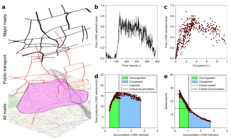
Traffic in an urban network becomes congested once there is a critical number of vehicles in the network. To improve traffic operations, develop new congestion mitigation strategies, and reduce negative traffic externalities, understanding the basic laws governing the network’s critical number of vehicles and the network’s traffic capacity is necessary.
However, until now, a holistic understanding of this critical point and an empirical quantification of its driving factors has been missing. Here we show with billions of vehicle observations from more than 40 cities, how road and bus network topology explains around 90% of the empirically observed critical point variation, making it therefore predictable. Importantly, we find a sublinear relationship between network size and critical accumulation emphasizing decreasing marginal returns of infrastructure investment. As transportation networks are the lifeline of our cities, our findings have profound implications on how to build and operate our cities more efficiently.